Privacy statement: Your privacy is very important to Us. Our company promises not to disclose your personal information to any external company with out your explicit permission.
Select Language
| measurement accuracy | |
| Measuring range | |
| Contato Agora |
Modelo: XR3000C
marca: Rxiry
Período De Garantia: 3 anos
Personalização De Suporte: OEM, ODM
| Unidades de venda: | Piece/Pieces |
|---|
Incoterm: FOB,CFR,CIF,EXW
RACHIRY RANGE RANGE RIME
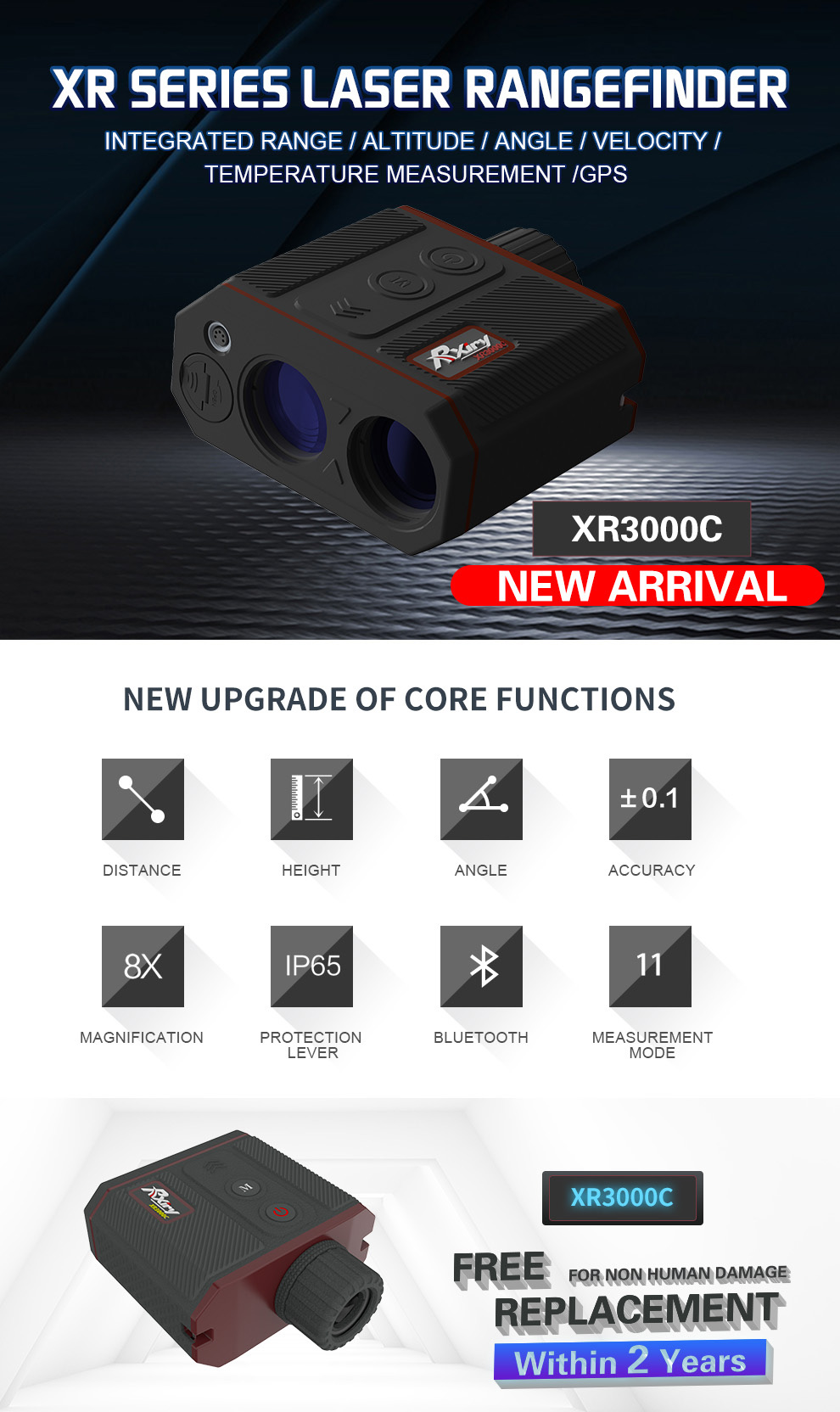
Rxiry XR Series Laser RangeFinder , um instrumento de levantamento final para profissionais. Em um design ergonômico , robusto e fácil de segurar, há um botão de incêndio, também chamado de botão de medição e botão de modo. Fácil de operar.
Em segundo lugar, vamos analisar as principais especificações
Oferece 8 x ótica superior que aprimoram seu campo, resolução de 0,01 e precisão da faixa de 0,1M, a faixa máxima pode ser de 6100m.
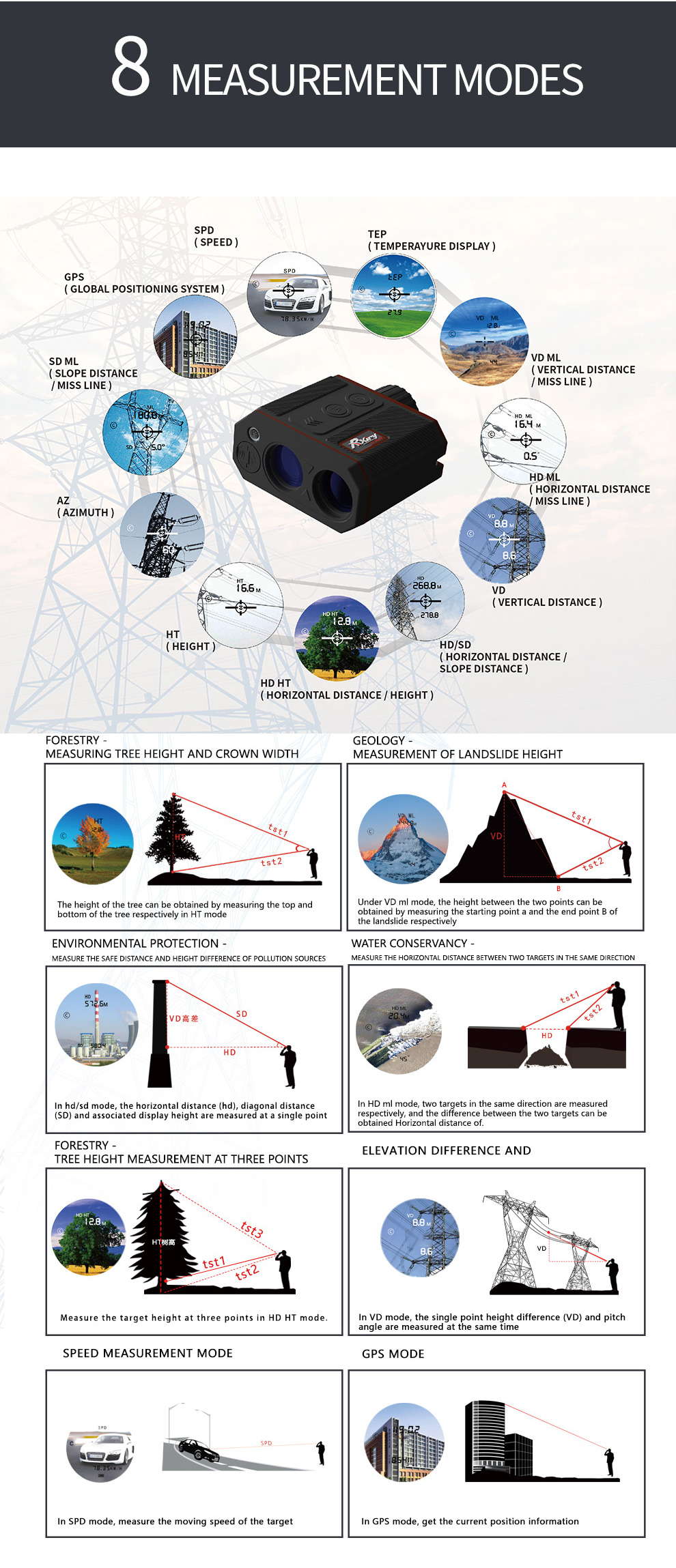
Capacidade com AZ + Inc + SD cálculos de bordo: calcula a distância horizontal (HD) + Distância Vertical (VD) + Altura (HT) + Linha ausente 3D (ML)
Se a sua medição estiver em questão, você poderá alternar no modo de fechamento e distante para garantir que o sensor a laser esteja ignorando obstruções indesejadas que estão na frente ou atrás do alvo desejado.
Para obter mais estabilidade, use Th4 1/4 ''-20 Thread para montar o rangefinder em uma equipe ou monopod.
| SD Slope Distance |
Straight line distance between the rangefinder and the target. |
| VD Vertical Distance |
The distance between the target and the perpendicular to the path of the horizontal distance. |
| HD Horizontal Distance |
The level distance between the rangefinder and the plane of the target |
| INC Inclination |
The angle of inclination between the rangefinder at level and the target. |
| AZ Azimuth |
The magnetic heading to the target referenced to magnetic North |
| HT Height |
Three-step height routine. The final calculation represents the vertical distance between the points on the target represented by ANG1 and ANG2. |
| ML Missing Line |
Two-step Missing Line Routine finds the connecting vector (or missing line) between two points. The final calculation shows the SD, VD, HD, and INC associated with the missing line |
| SPD Speed |
Measure the speed of moving target |
| GPS | Collect the rangefinder GPS position information |


The file is encrypted. Please fill in the following information to continue accessing it


Privacy statement: Your privacy is very important to Us. Our company promises not to disclose your personal information to any external company with out your explicit permission.

Fill in more information so that we can get in touch with you faster
Privacy statement: Your privacy is very important to Us. Our company promises not to disclose your personal information to any external company with out your explicit permission.